

Tobha Ronaigh [Toa Rona]
Good walks are even better shared.
Overview
Introduction
Tobha Ronaigh, elevating to 511 meters, is a gem nestled in the breathtaking Scottish Highlands. Perfect for those looking for an escape from the hustle and bustle of urban life, it offers walkable trails rich in scenery and tranquillity.
Geology
The geology of Tobha Ronaigh is characterised by ancient basalt formations, remnants of volcanic activity that forged these highlands long ago. Erosion has sculpted the landscape over millennia, revealing the rugged features we see today.
Routes
Two main routes lead to the summit: The Approach from Loch Ailort and a more adventurous Coastal Path Approach. The first offers a moderate challenge while the second tests your endurance, rewarding you with breathtaking coastal views.
Summit Features
Reaching the summit, hikers are greeted by a humble stone cairn, seemingly inviting one to stop and take a moment to absorb the serene surroundings. The sense of peace at this altitude can be the perfect backdrop for enjoying a packed lunch (preferably not soggy!).
Terrain
Expect varied terrain—smooth grassy paths interspersed with rocky outcrops and a few treacherous muddy patches to keep you on your toes. It’s the Highlands, after all!
Views
Once atop, the views are simply breathtaking: the hills of Knoydart rise majestically in the distance, whilst the loch glistens in the sunlight. Time of day and season can dramatically alter the vista; mornings tend to be crisp, while evenings can paint the sky in hues of orange and purple.
Hazards
As with any Highlands walk, caution is advised: watch out for loose stones, slippery mud, and that mischievous Highland weather that can change on a dime!
Access
Reaching Tobha Ronaigh is straightforward, with a decent car park at Loch Ailort followed by well-marked paths leading up. Public transport is an option too, with train and bus services connecting nearby towns.
Facilities
While facilities around Tobha Ronaigh are minimal, Arisaig is not too far away and offers a small cafe and shops for essentials - because let’s face it, you might need a hot chocolate after your hike!
History
The name Tobha Ronaigh recalls a well steeped in local lore and life, reminding us of the natural resources that have sustained generations. The area is rich with stories, making the hike not just one of exercise but also of exploration through history.
Tobha Ronaigh awaits your footprints upon its soft, breezy slopes. Gear up and enjoy what the Highland wilderness has to offer, just don’t forget your sense of adventure (and maybe a spare snack or two)!
Explore routes near Tobha Ronaigh [Toa Rona]
Public walks starting within 80 km of this hill. Nearby does not mean a route reaches the summit; check its map and access before setting out.
No public routes are currently listed within 80 km of Tobha Ronaigh [Toa Rona] on Walkmates. This does not mean there are no paths here. Explore the map and check local access information before planning a walk.
Route planning notes
These notes describe possible approaches, not verified navigable routes or permission to cross land. Check current paths, local access rules and conditions before setting out.
Tobha Ronaigh Approach from Loch Ailort
A scenic walk through heather-covered hills leading to Tobha Ronaigh, offering stunning views of the surrounding peaks.
Coastal Path Approach
A longer route that follows the coastline before ascending the slopes of Tobha Ronaigh. Ideal for those who love sea views and wildlife.
Make a day of it, together
Find someone to share the walk with, or organise a day out along a route you like.
Photo Gallery
View all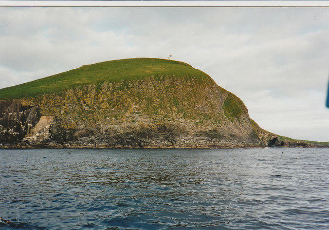 Photo could not load
HW8132 : Coming up to Rona
john m macfarlane
 Photo could not load
HW8132 : North Rona
Roddy MacDonald
 Photo could not load
HW8132 : Tobha Rònaigh
Rude Health
 Photo could not load
HW8132 : North Rona
Michael Earnshaw
Hill facts and local notes
Classifications
Elevation
108m
354 ft
Prominence
108m
Coordinates
59.1211, -5.8150
HW817322
OS Map
8
Explorer: 460E
At the Summit
The summit is adorned with a modest stone cairn, providing a fantastic vantage point for photos. There's also a sense of stillness that makes the top a perfect spot for contemplation - or for enjoying that well-deserved snack!
Terrain & Geology
Tobha Ronaigh features predominantly basaltic formations as a result of ancient volcanic activity. The erosion of these rocks has left behind stark, rugged landscapes that are both fascinating and steeped in geological history.
Views & Scenery
From the summit, you can feast your eyes on the stunning vistas of the nearby hills of Knoydart, the tranquil waters of Loch Ailort, and the distant islands of Eigg and Muck.
History & Heritage
Name Origin
Tobha Ronaigh translates to 'the well of Ronaigh', referencing historical and cultural ties to past inhabitants and their reliance on natural water sources.
Historical Significance
The region is rich in history, with remnants of the clearances and ancient settlement patterns visible to keen eyes. It’s also nestled in an area steeped in tales of legends.
Getting There & Facilities
Check current local access restrictions, parking rules and transport timetables before travelling. These notes do not confirm public access to the summit.
Parking
The nearest parking is available at the Loch Ailort car park (approximately 5 km from the trailhead).
Public Transport
You can reach Loch Ailort via the West Highland Line railway, with services connecting from Glasgow. A bus service also operates in the area.
Nearby Facilities
Facilities are limited in the immediate area; however, Arisaig has a cafe, public toilets, and shops for supplies.
Safety Information
Known Hazards
- Loose stones on the path, muddy patches, sudden weather changes common in the Highlands.
General Safety Tips
- Check weather conditions before setting out
- Carry appropriate clothing and equipment
- Let someone know your planned route
- Take a map, compass, and GPS device
- Carry emergency supplies: food, water, first aid kit, torch
Hills
Some common questions about the hills answered
Are there group walks up Tobha Ronaigh [Toa Rona]?
Many walkers use Walkmates to join or organise walks with others. You can check for group walks around Tobha Ronaigh [Toa Rona] through the maps
Are there other walkers around Tobha Ronaigh [Toa Rona]?
Activity varies by location and time, but Walkmates lets you see whether others have shared walks or shown interest in this area. Find other people through the walking friends search walking friends for Tobha Ronaigh [Toa Rona] search or of course create your own walk for Tobha Ronaigh [Toa Rona]
Can I organise a walk to Tobha Ronaigh [Toa Rona]?
Yes. If there aren’t any walks listed already, you can create a walk and make it available for others to join.
If you're signed up to Walkmates, you can create a walk to Tobha Ronaigh [Toa Rona].
How do I find a walk up this hill?
There are often multiple ways to walk this hill, depending on experience and route preference. Walkmates helps you explore walks and routes that others have shared.
Can I suggest a new route up Tobha Ronaigh [Toa Rona]?
Yes. You can suggest or create routes to share with others. Walkmates focuses on the social side of walking, so routes are used to help people organise walks and explore areas together, rather than as detailed navigation tools or route libraries.
Other uses really appreciate knowledgeable walkers sharing their routes. Share your favourite route to Tobha Ronaigh [Toa Rona] here
The is an error or something incorrect about this hill. How do I let you know?
We always strive to keep the information on Walkmates as accurate as possible. If you find an error, please let us know through the contact form and we'll aim to correct it as quickly as possible
Community Discussion
Comments
Location
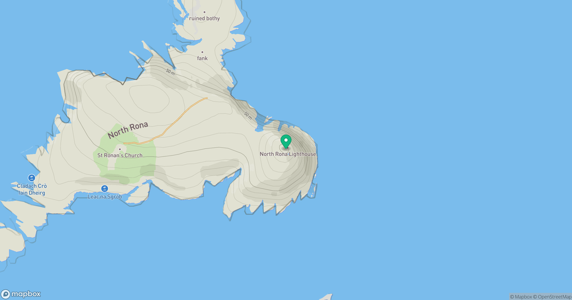
Grid reference: HW817322
View on OpenStreetMapOpens a map in a new tab, centred on the hill.
Hills within 30 km
No other hills are currently listed in this nearby selection. Explore the map for other places to walk.
Explore this area on the map
No comments yet. Be the first.